GEOTECHNICAL ENGINEERING
GARLAND
HomeGeophysicsElectrical resistivity / VES (Vertical Electrical Sounding)

Electrical Resistivity (VES) Surveys in Garland, TX

Evidence-based design. Reliable delivery.

LEARN MORE

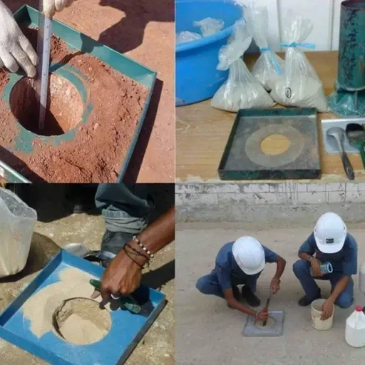
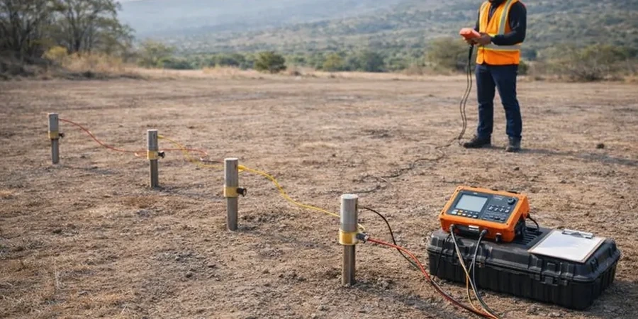
Garland sits at roughly 550 feet elevation on the Blackland Prairie, where the Eagle Ford Shale and Austin Chalk create sharp resistivity contrasts that aren't always obvious from the surface. We run VES surveys here weekly, mapping the contact between expansive clay and weathered limestone before excavation starts. With a population exceeding 240,000, the city has seen steady commercial growth along I-635 and the Bush Turnpike, and nearly every new pad site benefits from knowing what's underground before the first backhoe arrives. The clay-shale interface in Garland can vary by 10 feet across a single lot, and guessing wrong leads to costly surprises. Our field crew sets up the 4-electrode array, runs the Schlumberger configuration, and delivers a layered resistivity model the same week. The data often reveals perched water within the Taylor Marl that standard borings miss entirely, which is why combining resistivity with a CPT test gives you a much tighter picture of the subsurface profile.

A resistivity profile across Garland's Blackland Prairie clay can identify a 2-foot sand lens at 20 feet depth that completely changes your foundation design.

Our service areas

Methodology and scope

In Garland's older industrial corridors near Miller Road, we've repeatedly found that clay resistivity drops below 5 ohm-m within the first 15 feet, which points to saturated, highly plastic soils that will move under load. That signature is completely different from the 20-40 ohm-m readings we get in the limestone benches further west toward Richardson. The method works because current flows through pore water, not through the mineral grains, so a low-resistivity zone almost always means either high moisture or high clay content. We run a standard Schlumberger array with AB/2 expanding to 100 meters, giving effective penetration to about 30 meters depth. Data inversion uses a smoothness-constrained least-squares algorithm, and we cross-check the resulting model against any available boring logs. For projects near the Trinity River floodplain, we also recommend a seismic refraction line to map the bedrock surface where resistivity alone can leave ambiguity at the transition zone.
Electrical Resistivity (VES) Surveys in Garland, TX
Technical reference — Garland

Local considerations

The risk profile differs between North Garland's creek valleys and the flat uplands south of I-30. In the north, we regularly encounter old alluvial channels filled with conductive organic silt that can be invisible to a boring on 50-foot spacing. A VES line across the property maps those channels continuously, showing exactly where the soft material pinches out. In the southern sections, the main hazard is differential weathering in the Austin Chalk. One sounding might hit competent rock at 12 feet while another 80 feet away shows 25 feet of weathered chalk with groundwater. If you skip the resistivity survey and rely solely on a 2-borehole program, you're blind to what happens in between. We've seen foundation contractors in Garland lose weeks redoing grade beams because they hit a clay pocket that nobody mapped. The cost of the survey is trivial compared to that delay.

Need a geotechnical assessment?

Reply within 24h.

Email: [email protected]

Reference standards

ASTM D6431-18 — Standard Guide for Using the Direct Current Resistivity Method, IBC 2021 — Section 1803 geotechnical investigation requirements, ASCE 7-22 — Minimum Design Loads and Associated Criteria

Technical data

ParameterTypical value
Array configurationSchlumberger (AB/2 up to 100 m)
Typical investigation depth30 m below grade
Clay resistivity range (Garland)2 to 15 ohm-m
Limestone resistivity range30 to 200 ohm-m
Data points per sounding25 to 35
Inversion methodL2-norm smoothness-constrained
Reporting standardASTM D6431-18
Field crew2-person team, 1 day per 4 VES

Frequently asked questions

How deep can a VES survey go in Garland soils?

With our standard Schlumberger array and AB/2 expansion to 100 meters, effective penetration reaches approximately 30 meters below grade. That covers most foundation and utility depths in the Dallas County area. For deeper targets, we can extend the array, but signal-to-noise ratio degrades in the conductive surface clays common across Garland.

What does one VES sounding cost for a residential lot in Garland?

A single VES sounding on a residential lot in Garland typically runs between US$720 and US$1,080. The exact figure depends on access conditions, array length needed for the target depth, and how quickly we can get the crew on site. We provide a fixed quote before any fieldwork begins.

Can resistivity tell the difference between wet clay and groundwater?

Not directly. Both wet clay and fresh groundwater produce low resistivity readings. The distinction comes from context: clay-rich zones show consistently low values across multiple soundings, while a groundwater table typically appears as a sharp boundary across the entire survey line. We cross-reference with boring logs when available, and a test pit at a key location resolves any remaining ambiguity.

How long does it take to get results?

Fieldwork for up to four VES soundings completes in one day. Data processing and inversion modeling takes 24 to 48 hours. The signed report with interpreted cross-sections and layer parameters is delivered within three business days of the field survey.

Location and service area

We serve projects in Garland and surrounding areas.

View larger map