GEOTECHNICAL ENGINEERING
GARLAND
HomeSlopes & WallsSlope stability analysis

Slope Stability Analysis for Garland Construction Projects

Evidence-based design. Reliable delivery.

LEARN MORE

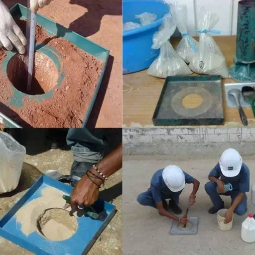
Garland's expansion eastward from Dallas brought development onto the Austin Chalk and Eagle Ford Shale formations, creating distinct geotechnical challenges on residential and commercial slopes. The city's 240,000 residents live across terrain where differential weathering of these sedimentary units produces variable shear strength profiles. Our laboratory conducts slope stability analysis that accounts for Garland's specific stratigraphy: the waxy, moisture-sensitive clays within the weathered Eagle Ford can lose significant strength after seasonal rainfall. For projects near Lake Ray Hubbard or along Duck Creek, we integrate data from test pits to map the contact between residual soil and weathered bedrock, a boundary that often controls the critical failure surface in local slope designs.

In Garland's Eagle Ford terrain, a slope can lose 30% of its factor of safety after just one wet winter if the weathered clay interface isn't modeled correctly.

Our service areas

Methodology and scope

The field phase typically begins with a track-mounted drill rig operating across Garland's irregular lots, extracting continuous samples through the weathered zone. Our lab then applies ASTM D1586 standard penetration testing to index the overburden, while triaxial testing on undisturbed Shelby tube samples provides the drained and undrained strength parameters required for limit equilibrium modeling. We cross-check these results against atterberg limits to quantify the expansive potential of the local clays, because shrink-swell cycles in Garland's hot summers progressively reduce the effective cohesion near the surface. The analysis itself runs on Rocscience Slide or GeoStudio SLOPE/W, using Spencer's method to satisfy both force and moment equilibrium for irregular geometries common in North Texas subdivisions.
Slope Stability Analysis for Garland Construction Projects
Technical reference — Garland

Local considerations

The most common mistake we see in Garland is designing a slope with peak strength parameters from unweathered shale and ignoring the softened, fully-softened friction angle of the near-surface clay. A contractor might excavate a cut for a retaining wall foundation, assume a cohesion of 500 psf, and end up with a failure during the October rainy season when the actual mobilized cohesion drops below 100 psf. Another critical error involves neglecting the perched groundwater that accumulates above the low-permeability Eagle Ford during spring storms. We've reviewed slope failures where the drainage design wasn't tied to a proper in-situ permeability test, leading to pore pressure buildup that limit equilibrium models could have predicted. In Garland's regulatory environment, the city's Engineering Department reviews slope stability reports against IBC Chapter 18, and a failed inspection can delay a project by months.

Need a geotechnical assessment?

Reply within 24h.

Email: [email protected]

Explanatory video

Reference standards

IBC 2018 / 2021 Chapter 18 (Soils and Foundations), ASCE 7-22 Section 11.8 (Seismic Slope Stability), ASTM D4767 (Consolidated Undrained Triaxial Test), ASTM D1586 (Standard Penetration Test), FHWA NHI-06-088 (Soils and Foundations Reference Manual)

Technical data

ParameterTypical value
Analysis methodLimit equilibrium (Spencer, Morgenstern-Price)
Design standardIBC 2018 Section 1806, ASCE 7-22
Minimum FoS (static)1.5 (permanent), 1.3 (temporary)
Seismic coefficient (k_h)Per USGS Garland grid coordinates
Soil shear strength inputConsolidated-undrained triaxial (ASTM D4767)
Groundwater modelingSteady-state and rapid drawdown scenarios
Back-analysisAvailable for existing failed slopes

Frequently asked questions

What factor of safety does Garland require for permanent slopes?

The City of Garland follows IBC Chapter 18, which defers to geotechnical recommendations. We typically design permanent cut and fill slopes for a minimum static factor of safety of 1.5, and 1.1 to 1.3 under pseudostatic seismic loading using the USGS-designated horizontal acceleration for the site's latitude and longitude.

How much does a slope stability analysis cost for a Garland residential lot?

For a typical single-family lot in Garland requiring a site investigation and limit equilibrium analysis, the cost ranges from US$1,080 to US$3,960 depending on the slope height, access conditions for the drill rig, and the number of cross-sections the city requires for permit approval.

Do you need to drill borings for a slope stability analysis?

Yes, a defensible analysis requires subsurface data. We perform SPT borings or test pits to log the stratigraphy and collect undisturbed samples. The weathered Eagle Ford contact depth is critical and cannot be reliably estimated from surface mapping alone in Garland.

How do you handle the expansive clay problem in Garland slopes?

We quantify the swelling potential through Atterberg limits and suction testing, then incorporate the expected strength reduction from seasonal moisture cycling into the long-term, fully-softened shear strength envelope used in the analysis.

Can you analyze an existing slope that has already moved?

Absolutely. We perform a back-analysis by iteratively solving the limit equilibrium model with factor of safety equal to 1.0 at the observed failure surface. This gives us the mobilized strength parameters, which we then use to design a stabilization strategy like a retaining wall or drainage improvements.

Location and service area

We serve projects in Garland and surrounding areas.

View larger map